The House Called “By Ways”
Henry H. Wells’s Eastview Avenue home — its sun parlor, its $7,000 listing, and its passage through four owners in four years — with a brief life of the family that gave Brewster its bank, its newspaper, and “Mr. Brewster” himself.
I. At a glance
“By Ways” was the Eastview Avenue residence of Henry H. Wells — the man who would become, in a centennial headline a half-century later, “Mr. Brewster.” The house carries a proper name in every clipping, the period habit of christening a fine home rather than numbering it, and it appears in the record across a tight thirteen-year window: present by the 1910 Sanborn map, given a sun parlor in 1913, listed for sale in 1922, and then sold, resold, and sold again until 1926.
What makes the property worth a piece of its own is that compression. In the four years from 1922 to 1926 “By Ways” passed through four hands — Henry H. Wells, then Charles Erickson of Mahopac, then a New York City singer named William Jones, then L. A. Reinhardt of the Associated Gas & Electric Company — each transfer reported in the Brewster Standard. The house is also a doorway into the Wells family, whose three generations sit behind a striking share of the village’s institutions and behind the development of Eastview Avenue itself.
One note belongs at the top. The clippings place the house on “Eastview avenue” (and, in 1913, “East View avenue”) but never give a street number, and this piece deliberately does not assign one — the parcel is identified by deed and metes-and-bounds, not by address. Section V sets out that title trail in full: an unbroken chain of deeds now runs back to a 1922 sale by Caroline C. Wells, matching, step for step, the newspaper’s account of how “By Ways” left the Wells family and passed to Erickson, Jones, and Reinhardt.
II. The Wells family — bank, newspaper, and “Mr. Brewster”
The Wells story in Brewster begins with Major Frank Wells (1841–1919). Born in Litchfield, Connecticut, he served as an officer in the 13th Connecticut Volunteers — the siege of Port Hudson and the Shenandoah Valley campaign under Sheridan — and settled in Brewster in 1869 as bookkeeper at Gail Borden’s milk condensery. He boarded with the widow Crosby on Main Street and married her daughter, Caroline Crosby. From the condensery he rose into the institution that would define the family, co-founding the village’s First National Bank (organized as Borden, Wells & Co.) as cashier and later president; for a time he also ran the Brewster Standard, and he commanded the Crosby Post of the Grand Army of the Republic. He died at his residence at the top of Prospect Street on December 17, 1919, in his seventy-ninth year. The cross street at the By Ways corner — Cornell Avenue, recorded in the deeds as “a.k.a. Wells Street” — carries the family name.
Frank Wells is also, separately, a figure behind the physical Eastview Avenue: the project’s narrative has him consolidating open land at the village’s eastern edge around 1903–1913 and selling building lots there — the “sister houses” on Eastview Avenue rose on lots he conveyed to the builder William M. Smalley about 1911. The By Ways lot, though, was not part of that activity. As the deed trail shows (Section V), it was carved out earlier and by a different hand: Octavia A. Mead subdivided her own Prospect Street land — cutting the two “new streets” — and sold this bare corner to Elias B. Brundage in 1894 for $400; Brundage appears to have built the house that year (he resold for $2,500 in 1895). It passed Brundage → Reed → Caroline C. Wells in 1902. So the family bought an existing eight-year-old house on a lot someone else had platted; they neither cut the streets nor raised the house. The lot’s origin lies with Mead and Brundage, not the Wellses.
Henry Hubbard Wells (1877–1978), the youngest of Frank and Caroline’s three children, was the “By Ways” resident the 1913 clipping names. Born in his grandmother Crosby’s Main Street home, schooled at Hotchkiss and Yale (1900), a Spanish-American War veteran, he trained in law and married Caroline Washburn in 1909 — a second Caroline Wells, not to be confused with his mother. By the time his father died in 1919 he was practicing law in White Plains (the obituary calls him “of White Plains”); a 1977 centennial profile describes him returning to Brewster after that death, needed to attend to the family’s affairs, and settling not back on Eastview but into a home remodeled from Samuel Church’s former “Casino” near the Prospect Street house. He went on to be mayor (1935–1947) and Putnam’s long-serving Selective Service director, the “Mr. Brewster” who saw servicemen off at the railroad station; the village middle school carries his name. The “Casino” and “By Ways” were always distinct houses, and the record keeps them apart.
That sequence resolves the one name the deed trail turned on. The 1922 grantor was Caroline C. Wells — and the middle initial is the key: C for Crosby. The seller was Caroline Crosby Wells (1850–1939), Frank’s wife and (by 1922) widow — not Henry’s wife, Caroline Washburn Wells. The 1902 deed sharpens it further: Caroline bought this lot in her own name in 1902, while Frank was still living, and held it for twenty years. So the occupancy-versus-title distinction is unusually clean here — the lot was Caroline’s throughout (1902–1922), while her son Henry was the one living at “By Ways” in 1913; she sold it in 1922 once he had moved on. (Two small uncertainties are worth keeping: the obituaries give Frank and Caroline’s marriage as 1871 in some notices and 1874 in others; and the Crosby line — Caroline’s mother was the widow Pauline Crosby of Main Street — is locally prominent, but any tie to the Enoch or Fanny Crosby of the project’s other markers is unproven.)
III. The house: a sun parlor and a $7,000 listing
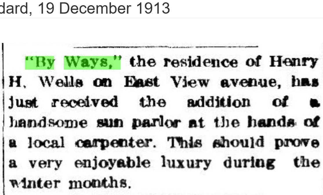
The first dated glimpse of the house as the Wells home is a small society note from the winter of 1913 — a carpenter’s improvement worth a paragraph in the Standard:
“By Ways,” the residence of Henry H. Wells on East View avenue, has just received the addition of a handsome sun parlor at the hands of a local carpenter. This should prove a very enjoyable luxury during the winter months.
— Brewster Standard, December 19, 1913
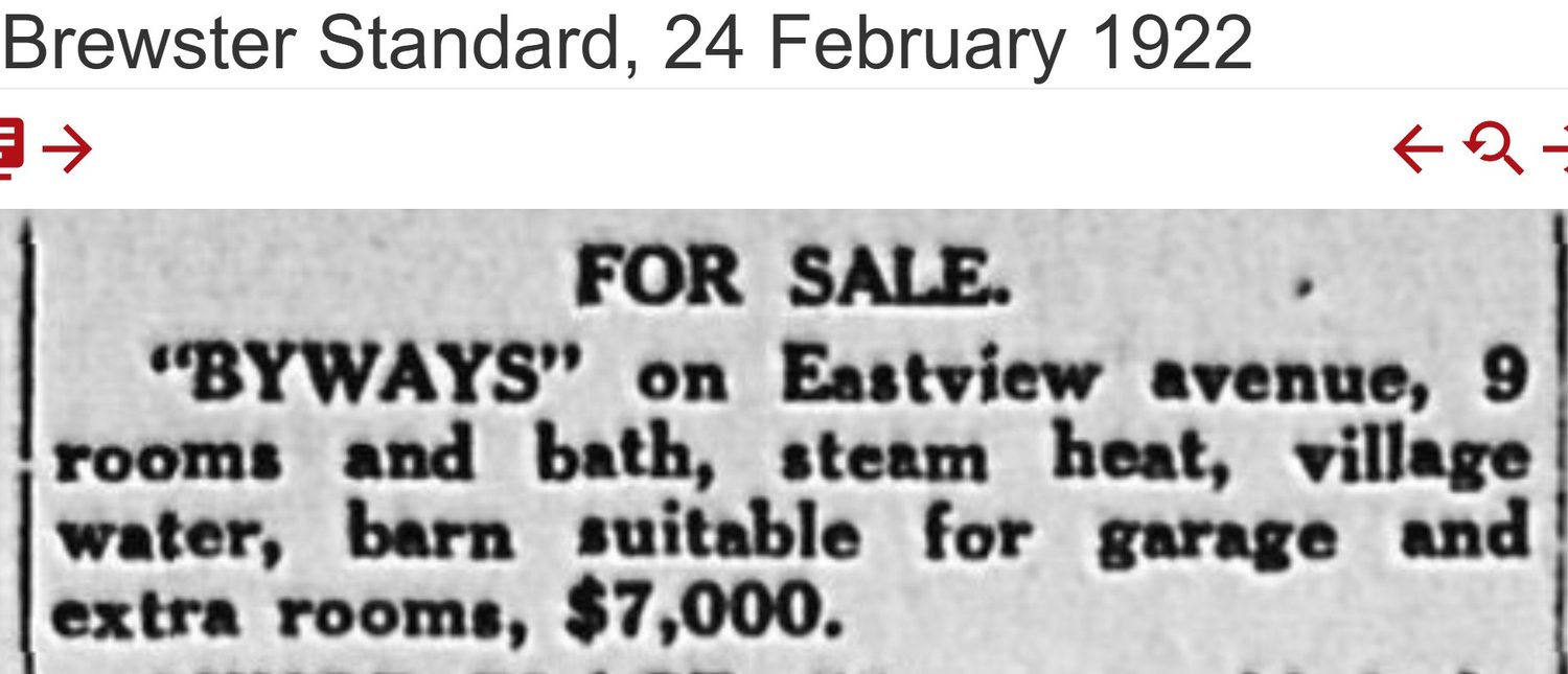
Nine years later the house is described far more fully — in its own for-sale advertisement. It gives the only physical inventory of “By Ways” in the record: nine rooms and a bath, steam heat, village water, and a barn “suitable for garage and extra rooms,” offered at $7,000. That is the profile of a substantial, fully modern home for the early 1920s — central heat and municipal water were not universal — and the barn-to-garage line catches the exact moment the automobile was displacing the horse.
IV. Four owners in four years, 1922–1926
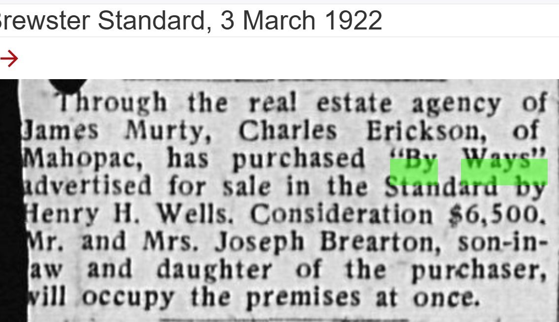
Within days of the listing, the house was sold. On March 3, 1922 the Standard reported that Charles Erickson of Mahopac had bought “By Ways” through the real-estate agent James Murty, for a consideration of $6,500 — five hundred dollars under the asking price — and that Erickson’s daughter and son-in-law, Mr. and Mrs. Joseph Brearton, would “occupy the premises at once.” Title and occupancy already part company here: Erickson bought, the Breartons lived in it.
Erickson held the house only briefly. By the time it changed hands again — reported April 16, 1926 — the owner of record was no longer Erickson but William Jones, described as a “noted singer of New York City,” and the buyer was L. A. Reinhardt, superintendent of the Associated Gas & Electric Company for its Harlem Valley Division. The same item supplies, in one sentence, the chain it had been building all along:
James Murty, real estate agent, has sold “By Ways,” the residence property of William Jones, noted singer of New York City, to L. A. Reinhardt… The property was formerly the home of H. H. Wells, and for a short time was owned by Charles Erickson. During the past year Mr. and Mrs. L. A. Reinhardt and family have lived at “By Ways.”
— Brewster Standard, April 16, 1926
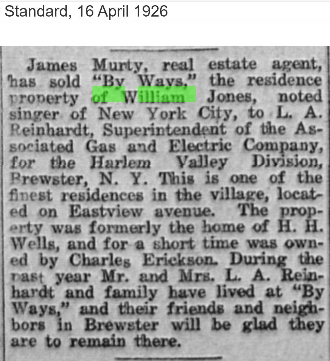
So the reported sequence is Wells → Erickson (March 1922) → Jones → Reinhardt (1926) — with the Reinhardts occupying the house roughly a year before they bought it. This corrects the earlier project narrative, which carried the house straight from Erickson to Reinhardt and left William Jones out entirely. It is worth stating plainly what kind of evidence this is: these are newspaper accounts of ownership and occupancy, valuable and contemporary but not the same as a reviewed deed. The chain is firm enough to publish as a reported chain; promoting it to a documented one means pulling the conveyances, which have not yet been examined.
V. The parcel — tracing the title back to “By Ways”
The chain of title for this corner is now documented and continuous from the present back to 1894, when the lot was first carved out. Every step the newspapers reported in Sections III–IV has a deed behind it, and the deeds add the links the papers never mention. The full chain — with Liber and page for each conveyance, and a tier marking which were read in full versus carried only by recital — is set out in the table below and detailed deed-by-deed in the Sources. What follows is what that trail establishes.
The lot is the eastern half of a single block that Octavia A. Mead bought in 1890 (Book 71/555, $800) and split in 1894. She sold this bare corner to Elias B. Brundage for $400 in February 1894 (Book 75/474, the lot’s creation); Brundage resold a year later for $2,500 (Book 76/525), and the jump from bare-lot to improved price is the clearest sign the house went up in 1894 — an inference from price, not a statement in the deeds. From Brundage the lot passed through Deborah H. Reed to Caroline C. Wells in 1902 (Book 90/69), who held it for twenty years in her own name. That single deed is what ties the parcel to the family: when “Caroline C. Wells” sold it in 1922, the seller was Caroline Crosby Wells, the Major’s widow, not her son Henry’s wife.
From 1922 forward the deeds run name-for-name and date-for-date with the Brewster Standard’s account of “By Ways”: Caroline C. Wells → Erickson (March 1922, Book 122/525, the sale the paper reported), Erickson → Jones (1923, Book 126/277, consideration $7,000 — the exact 1922 asking price), and Jones → Reinhardt (1926, Liber 135/362). The 1938 corporate deed at Liber 237/442 then recites that whole sequence in a single paragraph, locking it together. This is the identification — a continuous, deed-documented chain whose parties and dates match the newspaper record exactly. It is worth stating its one limit plainly: no deed in the chain ever uses the words “By Ways” or “Wells” in its description, so the tie of this parcel to the named house, while very strong, is circumstantial rather than stated.
The recited 1926–1938 links also explain a detour the earlier narrative never saw: between Reinhardt and the post-war residents the corner passed through a gas-and-electric utility — Reinhardt → C M-M Corp. (1928) → Associated Real Properties (1928) → New York State Electric & Gas (1936) — before returning to private hands with the Heinens in 1939, the chain’s first owner-occupants. From there it runs cleanly through the Alcorns, Thomas Johnson, the Griffins and their family trust, Louise Davis, Vatne and Hobbesland, Braun and Sattinger, and the Rogerses to the present owners.
Behind the lot, the record reaches the founding era but stops short of one splice. Mead’s 1890 parent-tract deed carries forward a reservation of all iron ore from a Samuel Brewster–to–Albert Brush deed of 1849 (~100 acres, $6,825) — the same iron-ore reservation that identifies the whole Eastview / St. Lawrence O’Toole cluster and threads through every property in it. That 1849 farm is almost certainly the ground the block was cut from, but no reviewed deed yet places the 264 × 60-ft block inside the farm’s bounds, so the ancestral farm is shown below as a separate, older chain rather than spliced on. The remaining backward work is the grantee-index search that would fill the 1849–1890 Brush-heir links.
| Conveyed | Grantor → Grantee | Liber / Page | Dimensions | Notes & status |
|---|---|---|---|---|
| Aug. 9, 1999 | T. & S. Rogers → Current Owners | 1481 / 237 (BK 1481 PG 238) |
60.00 × 130.10 ft corner rectangle |
Bargain & sale; $10 + OVC (nominal). Schedule A: NW corner Eastview Ave. & Cornell Ave. (a.k.a. Wells St.); abutters Truran, Lawlor, Howley. Recites source deed 1005/170. Reviewed |
| dated Feb. 22, 1988 rec. Apr. 22, 1988 |
S. Braun & B. Sattinger → T. & S. Rogers | 1005 / 170 | 60.00 × 130.10 ft corner rectangle |
Bargain & sale; $10 + OVC (nominal). Identical metes-and-bounds, bearings, and abutters (Truran, Lawlor, Howley) to the 1999 deed — same parcel confirmed. No source-deed recital; predecessor is 792/61 per the card. Reviewed |
| July 21, 1983 | Bjarne Vatne → S. Braun & B. Sattinger (tenants in common) |
792 / 61 | 60.00 × 130.10 ft corner rectangle |
Bargain & sale; NY transfer tax $112.20 ⇒ ~$102,000 (inferred). Same bounds & abutters (Truran “formerly Storm,” Lawlor, Howley); deed states Tax Map Sec. 5 / Block 3 / Lot 2 — the card’s parcel, named in the deed itself. Recites two source deeds: 716/978 and 732/1003. Reviewed |
| c. 1973–83 | J. Hobbesland → B. Vatne (inferred) |
732 / 1003 | — | Named by 792/61; likely Vatne buying out his co-owner’s half-interest to convey alone in 1983. Pull next |
| Dec. 27, 1973 | Louise Davis → B. Vatne & J. Hobbesland | 716 / 978 | 60 × 132 ft (old) 60.00 × 130.10 (survey) |
$100 + OVC; buyers then non-resident (Mahopac / NJ). Carries both the modern survey and an older description — “new streets,” ref. Octavia A. Mead (Prospect St.) & Harriet Storm. Explains the card’s “Vante & Hobbeland” (= Vatne & Hobbesland) and “Dakes” (= Davis). Source: 658/27. Reviewed |
| Nov. 11, 1967 | Griffin family trust (trustees) → Louise Davis | 658 / 27 | 60 × 132 ft (old desc.) | Gift ($1, no stamps), per the 1966 trust. Trustees: Helen Griffin, Thompson, DePaoli, Fleck, Pilner. Old description (Mead / Storm / “new streets”). Card’s “Dakes” = Davis. Reviewed |
| July 22, 1966 | W. Kenneth & Helen Griffin → Wm. K. Griffin & W. Pilner (trustees) | 658 / 25 | 60 × 132 ft (old desc.) | Gift into the Griffins’ own trust ($1, no stamps). Recites source 466/337: the Griffins bought from Thomas Johnson, Oct. 5, 1955. Card’s “Helen & Gilmer Griffin” garbles these trustees. Reviewed |
| Oct. 5, 1955 | Thomas Johnson → W. Kenneth & Helen Griffin (tenants by the entirety) |
466 / 337 | 60 × 132 ft (old desc.) | Warranty deed, full covenants; ~$15,000 (stamps $16.50, per card). Old description; “buildings… thereon.” Johnson of Tilly Foster (non-resident). No source recital — Johnson’s predecessor is not named here. Reviewed |
| Apr. 21, 1947 | R. J. & M. D. Alcorn → Thomas Johnson | 330 / 242 | 60 × 132 ft (old desc.) | Warranty deed; stamps $13.75 ⇒ ~$12,500 (inferred). Old description, “buildings… thereon.” Found via the grantee index. Recites source 307/245: the Alcorns bought from the Heinens, Apr. 1946. Reviewed |
| Apr. 23, 1946 | Edward E. & Edith G. Heinen → R. J. & M. D. Alcorn | 307 / 245 | 60 × 132 ft (old desc.) | Full-covenant deed; $1 + OVC, three stamps (denoms. not transcribed). Heinens resided at the property — first owner-occupants in the chain. Recites source 239/262: bought from the Ramseys, Mar. 1939. Reviewed |
| Mar. 9, 1939 | J. Raymond & Elizabeth B. Ramsey → E. E. & E. G. Heinen | 239 / 262 | 60 × 132 ft (old desc.) | Full-covenant deed; $1 + assumed $4,950 mortgage (Putnam County Savings Bank); stamps $7.00 (⇒ total value ~$11,000, inferred). Ramseys held ~5 months. Recites source 237/442: bought from New York State Electric & Gas Corp., Oct. 1938. Reviewed |
| Oct. 17, 1938 | New York State Electric & Gas Corp. → J. R. & E. B. Ramsey | 237 / 442 | 60 × 132 ft (old desc.) | Corporate full-covenant deed (by Harry Reid, Pres.); $1, stamp $1.00; subject to Mabel C. Reinhardt’s $5,500 Putnam County Savings Bank mortgage. Recites the full chain of title back to 1926 (the four rows below). Reviewed |
| June 20, 1936 | Associated Real Properties, Inc. → New York State Electric & Gas Corp. | 218 / 415 | — | Recited in 237/442. Recited |
| Nov. 19, 1928 | C M-M Corporation → Associated Real Properties, Inc. | 154 / 242 | — | Recited in 237/442 (para. E). The Associated Gas & Electric system’s property arm. Recited |
| May 29, 1928 | Mabel C. Reinhardt → C M-M Corporation | 145 / 341 | — | Recited in 237/442. The Reinhardts’ sale into the corporate system. Recited |
| May 3, 1926 | William R. Jones → Mabel C. Reinhardt | 135 / 362 | 60 × 132 ft (old desc.) | Now reviewed (confirms the 237/442 recital). Jones of W. 111th St., NYC, “unmarried” — consistent with the “noted singer of New York City” the Standard named. Same Jones→Reinhardt sale the paper reported as “By Ways.” No source recital — does not name Jones’s grantor, Erickson, Wells, or “By Ways.” Reviewed |
| Aug. 1, 1923 | Charles J. & Hannah M. Erickson → William R. Jones | 126 / 277 | 60 × 132 ft (old desc.) | Full-covenant deed; $7,000 (real consideration — matches the 1922 asking price). Same lot. Recites source 122/525: Caroline C. Wells to Erickson, Mar. 13, 1922 — the Wells→Erickson sale, by deed. Reviewed |
| Mar. 13, 1922 | Caroline C. Wells → Charles J. Erickson | 122 / 525 | — | The Wells→Erickson sale the Standard reported (1922). Recited in 126/277; bracketed by the two reviewed deeds around it (Caroline’s 1902 purchase below, Erickson’s 1923 sale above), so her tenure is documented though this deed itself is not yet pulled. Recited |
| Nov. 10, 1902 | Deborah H. Reed → Caroline C. Wells | 90 / 69 | 60 × 132 ft (old desc.) | Caroline’s acquisition — full-covenant deed, $2,900, Reed of Mt. Vernon to Caroline C. Wells of Brewster. Same lot; the “new streets” already exist. Notary Frederic S. Barnum (later Henry H. Wells’s law partner). Recites source 76/525: Brundage to Reed, 1895. Reviewed |
| Jan. 16, 1895 | Elias B. Brundage → Deborah H. Reed | 76 / 525 | 60 × 132 ft (old desc.) | Warranty deed, $2,500; subject to a $1,300 mortgage to Hannah E. Bowen (Feb. 1894). Same lot. Recites source 75/474: Octavia A. Mead to Brundage, Feb. 3, 1894 — naming the abutter who anchors every description in this chain as the lot’s origin. Reviewed |
| Feb. 3, 1894 | Octavia A. Mead → Elias B. Brundage | 75 / 474 | 60 × 132 ft (old desc.) | The lot’s creation. Warranty deed; $400 — a bare lot, carved from Mead’s own Prospect Street parcel (named here as “the lot of party of first part”). Mead kept a repurchase option. Notary Frederic S. Barnum. No source recital — Mead’s parent tract not named. (Brundage resold for $2,500 eleven months later: a house was almost certainly built in 1894.) Reviewed |
| July 28, 1890 | J. H. & A. S. Brush and Sarah E. Van Scoy → Octavia A. Mead | 71 / 555 | 264 × 60 ft (parent tract) | Mead’s parent tract. Warranty deed, $800 — the full block between Prospect Street, Storm, and the two streets, then only “proposed.” Mead later split it 132 + 132: kept the Prospect Street half, sold the east corner (this lot) to Brundage in 1894. Grantors scattered (California, Iowa, Putnam) — evidently Brush heirs. Reserves iron/mineral rights “as reserved in the deed of Samuel Brewster and wife to Albert Brush.” Reviewed |
| Ancestral farm — a separate, older chain; not yet shown to contain the block | ||||
| Aug. 15, 1849 | Samuel Brewster & Eliza L. → Albert Brush | (farm deed) | ~100 ac. + 4.5 ac. | The founding-era source of the reserved minerals: a ~100-acre Southeast farm near Brewster Station, $6,825, reserving “all iron ore… now or hereafter found” — the very reservation carried forward into the 1890 deed. The land later passed (through Albert Brush’s heirs) to the 1890 sale, but its farm bounds are not yet shown to include the 264 × 60 block. Farm chain |
| Mar. 20, 1851 | Albert Brush & Julia → Samuel Brewster | (farm deed) | ~3 ac. (two parcels) | A related founding-era transaction the other direction — Brush quitclaiming two small farm parcels back to Brewster ($431). Context for the Brush–Brewster dealings, not a link in this lot’s descending chain. Context |
| before 1849 | (?) → Samuel Brewster; and the farm→block link | index search | — | Two open questions: how Samuel Brewster held the farm (toward the patent-era horizon), and whether this farm actually contained Mead’s 1890 block (the Brush-heirs links, 1849–1890, are unfilled). Then back |
| The lot’s own life (1894–present) is fully reviewed, and its parent block traces to Mead’s 1890 purchase. Behind that, the reserved-iron-ore clause is a fingerprint linking the 1890 deed to a founding-era farm: Samuel Brewster sold Albert Brush a ~100-acre farm in 1849, reserving the ore, and that reservation propagated down to 1890. That 1849 farm is almost certainly the ancestral ground — but it is shown here as a separate chain until a deed demonstrates the 264 × 60 block lay within it and the 1849–1890 Brush-heir links are filled. | ||||
The title to this corner is settled; whether the house standing on it today is the original Wells “By Ways” is a separate question, deliberately left open. A structure stands continuously on the lot from 1922 forward, which weighs for it — but a Helen Griffin appears connected both to this corner (the Griffins held it 1955–1967) and to the neighbouring Ganong parcel (Lot 20), and a house was moved onto a Griffin property nearby in 1959. Until the Lot 20 deeds naming her are pulled and reconciled against the Lot 19 Griffin deeds, the building’s identity carries that reservation. The two images on this page — the “By Ways” postcard and the photograph of the corner Queen Anne — rest on local identification and the deed-confirmed corner respectively; neither is yet tied to the other by a document.
Sources Consulted
- December 19, 1913 — “By Ways,” residence of Henry H. Wells on East View avenue, receives a sun-parlor addition by a local carpenter. The earliest dated tie of the name to the Wells household.
- February 24, 1922 — for-sale advertisement: “BYWAYS” on Eastview avenue, 9 rooms and bath, steam heat, village water, barn suitable for garage and extra rooms, $7,000. The only physical description of the house.
- March 3, 1922 — Charles Erickson of Mahopac buys “By Ways” (advertised by Henry H. Wells) through agent James Murty for $6,500; Mr. and Mrs. Joseph Brearton, the purchaser’s daughter and son-in-law, to occupy at once.
- April 16, 1926 — James Murty sells “By Ways,” then the property of William Jones, “noted singer of New York City,” to L. A. Reinhardt of the Associated Gas & Electric Co. (Harlem Valley Division); recites the prior Wells and Erickson ownership and a year of Reinhardt occupancy.
- Deed, Liber 1481 / p. 237 (recorded BK 1481 PG 238–239), bargain-and-sale, dated Aug. 9, 1999 — T. & S. Rogers to the current owners (names withheld). Physically reviewed. Schedule A fixes the parcel by metes-and-bounds at the NW corner of Eastview Avenue and Cornell Avenue (a.k.a. Wells Street), 60.00 × 130.10 ft, abutters Truran / Lawlor / Howley; recites source deed Liber 1005/170 (dated 2‑22‑88, rec. 4‑22‑88).
- Founding-era farm deeds (ancestral, not yet spliced to the lot). Samuel Brewster & Eliza L. → Albert Brush, deed of Aug. 15, 1849, ~100-acre Southeast farm near Brewster Station, $6,825, reserving all iron ore — the reservation the 1890 deed carried forward. Albert Brush & Julia → Samuel Brewster, quitclaim of Mar. 20, 1851, two small parcels, $431 (related context, reverse direction). Physically reviewed. These document the ancestral farm behind the Brush family; the farm’s bounds are not yet shown to contain the 264 × 60 block, and the 1849–1890 Brush-heir links are unfilled, so they are kept as a separate chain.
- Deed, Book 71 / p. 555, warranty deed, dated July 28, 1890 — Jacob H. Brush (Sonoma Co., Cal.), Avery S. Brush (Mitchell Co., Iowa), and Sarah E. Van Scoy (Putnam Co.) to Octavia A. Mead, $800. Physically reviewed. Mead’s parent tract — the full 264 × 60-ft block between Prospect Street, Harriet Storm’s land, and two then-“proposed” streets (the future Eastview Ave. and Cornell/Wells St.); Mead split it in 1894, this lot being the eastern 132 ft. Reserves iron/mineral rights per a prior deed of Samuel Brewster and wife to Albert Brush — the founding-era source behind the Brush family (whose scattered residences suggest heirs).
- Deed, Book 75 / p. 474, warranty deed, dated Feb. 3, 1894 — Octavia A. Mead to Elias B. Brundage, $400. Physically reviewed. The lot’s creation: carved from Mead’s own Prospect Street parcel (the anchor “lot of party of first part”), with a repurchase option retained by Mead; notary Frederic S. Barnum. No source recital — Mead’s parent tract is not named, so tracing the land before 1894 requires a grantee-index search for Mead. (The $400 bare-lot price against Brundage’s $2,500 resale in 1895 suggests a house was built on the lot in 1894 — an inference from price, not stated in the deeds.)
- Deed, Book 76 / p. 525, warranty deed, dated Jan. 16, 1895 — Elias B. Brundage to Deborah H. Reed, $2,500 (subject to a $1,300 mortgage to Hannah E. Bowen). Physically reviewed. Same Lot 19 description. Recites its source: Octavia A. Mead to Elias B. Brundage, deed of Feb. 3, 1894, Book 75/474 — identifying Mead, the abutter that anchors every description in the chain, as the lot’s origin. (Confirms the grantor’s name as Elias B. Brundage; the 1902 deed’s recital miswrote it “Elias V. Bruddage.”)
- Deed, Book 90 / p. 69, full-covenant deed, dated Nov. 10, 1902 — Deborah H. Reed (of Mount Vernon) to Caroline C. Wells (of Brewster), $2,900. Physically reviewed. Caroline’s acquisition of the lot; same Lot 19 description, “new streets” already cut. Notary Frederic S. Barnum (later Henry H. Wells’s law partner). Recites its source: Elias B. Brundage to Deborah H. Reed, deed of Jan. 16, 1895, Book 76/525 — establishing that the Wellses bought an already-platted lot rather than creating it.
- Deed, Book 126 / p. 277, full-covenant deed, dated Aug. 1, 1923 — Charles J. and Hannah M. Erickson to William R. Jones. Physically reviewed. Consideration $7,000 (matching the 1922 asking price for “By Ways”). Same Lot 19 description. Recites its source: Caroline C. Wells to Charles J. Erickson, deed of Mar. 13, 1922, Book 122/525 — placing a Wells on the title of this lot, and matching the Standard’s report of the 1922 sale of “By Ways.”
- Deed, Liber 135 / p. 362, full-covenant deed, dated May 3, 1926 — William R. Jones (of West 111th St., New York City, unmarried) to Mabel C. Reinhardt (of the Town of Southeast). Physically reviewed. Confirms the recital in 237/442; same Lot 19 metes-and-bounds. Carries no source recital — does not name Jones’s grantor, and uses neither the name “By Ways” nor “Wells.” Jones’s New York City residence and single status are consistent with the “noted singer of New York City” named in the 1926 Standard.
- Deed, Liber 237 / p. 442, corporate full-covenant deed, dated Oct. 17, 1938 (executed by Harry Reid, president) — New York State Electric & Gas Corporation to J. Raymond and Elizabeth B. Ramsey. Physically reviewed. Subject to Mabel C. Reinhardt’s $5,500 Putnam County Savings Bank mortgage. Recites the full prior chain: Wm. R. Jones → Mabel C. Reinhardt (Liber 135/362, May 3, 1926); Reinhardt → C M-M Corp. (145/341, 1928); C M-M Corp. → Associated Real Properties, Inc. (154/242, 1928); Associated Real Properties → NYSE&G (218/415, 1936). The 1926 link is the sale the Brewster Standard reports as “By Ways” — the point at which the deed chain and the newspaper record coincide (a circumstantial identification; the deeds themselves name neither “By Ways” nor Wells). The three 1928–1936 deeds are documented by this recital but not individually reviewed.
- Deed, Liber 239 / p. 262, full-covenant deed, dated Mar. 9, 1939 (acknowledged in Northampton County, Pa.) — J. Raymond and Elizabeth B. Ramsey to Edward E. and Edith G. Heinen (tenants by the entirety). Physically reviewed. Nominal $1 plus assumption of a $4,950 Putnam County Savings Bank mortgage; $7.00 documentary stamps (⇒ ~$11,000 total value, inferred). Recites the Ramseys’ source: New York State Electric & Gas Corp., deed of Oct. 17, 1938, Liber 237/442. Establishes that the corner was held by a gas-and-electric utility before 1938.
- Deed, Liber 307 / p. 245, full-covenant deed, dated Apr. 23, 1946 — Edward E. and Edith G. Heinen to Robert J. and Madelon D. Alcorn (tenants by the entirety). Physically reviewed. Nominal $1 + OVC; three documentary stamps (denominations not transcribed). The Heinens recorded their residence as the property itself — the chain’s first owner-occupants. Old development-era description. Recites the Heinens’ source: J. Raymond and Elizabeth B. Ramsey, deed of Mar. 9, 1939, Liber 239/262.
- Deed, Liber 330 / p. 242, warranty deed with full covenants, dated Apr. 21, 1947 — Robert J. and Madelon D. Alcorn (of Oak Street, Brewster) to Thomas Johnson (of Tilly Foster). Physically reviewed. Documentary stamps $13.75 (⇒ ~$12,500 inferred). Old development-era description, “buildings… thereon.” Recites the Alcorns’ source: Edward E. and Edith G. Heinen, deed of Apr. 23, 1946, Liber 307/245. Found via the grantee index for Thomas Johnson.
- Deed, Liber 466 / p. 337, warranty deed with full covenants, dated Oct. 5, 1955 — Thomas Johnson (of Tilly Foster) to W. Kenneth and Helen G. Griffin, as tenants by the entirety. Physically reviewed. ~$15,000 (documentary stamps $16.50, per the property card; the deed’s tax marking is illegible in this copy). Old development-era description, “buildings… thereon.” Carries no source recital — does not name Johnson’s grantor — so the next step is a grantee-index search for Thomas Johnson’s acquisition (1926–1955).
- Deeds, Liber 658 / pp. 25 and 27 (filed together), both read in full, both gifts (no stamps). 658/25, dated July 22, 1966 — W. Kenneth and Helen G. Griffin to William K. Griffin and Walter Pilner as trustees of the Griffins’ trust; recites that the Griffins took the premises from Thomas Johnson by deed of Oct. 5, 1955 at Liber 466/337. 658/27, dated Nov. 11, 1967 — the trustees (Helen Griffin, George Thompson, Thomas DePaoli, Sol Fleck, Walter Pilner) to Louise Davis. Both carry the older development-era description. Correct the card’s “Helen & Gilmer Griffin” (= Griffin & Pilner, trustees) and confirm “Dakes” = Davis.
- Deed, Liber 716 / p. 978, full-covenant, dated Dec. 27, 1973 — Louise Davis to Bjarne Vatne and Johannes Hobbesland. Physically reviewed. Consideration $100 + OVC. Carries two descriptions: the modern survey and an older development-era description fixing the corner by reference to a “new street,” Octavia A. Mead (fronting Prospect Street), and Harriet Storm; gives the depth as a round 132 ft (vs the survey’s 130.10). Establishes that the card’s “Vante & Hobbeland” is two grantees (Vatne & Hobbesland) and its “Dakes” is Davis. Grantor’s source recorded at Liber 658/27.
- Deed, Liber 792 / p. 61, bargain-and-sale, dated July 21, 1983 — Bjarne Vatne to Stephen Braun and Beth Sattinger, as tenants in common. Physically reviewed. Same metes-and-bounds and abutters (Truran “formerly Storm,” Lawlor, Howley); states Tax Map Sec. 5 / Block 3 / Lot 2; NY transfer tax $112.20 (⇒ ~$102,000 inferred). Recites two source deeds into Vatne: Liber 716/978 and Liber 732/1003. Corrects the card’s “Vante & Hobbeland” to the single owner Bjarne Vatne.
- Deed, Liber 1005 / p. 170, bargain-and-sale, dated Feb. 22, 1988, recorded Apr. 22, 1988 — Stephen Braun and Beth Sattinger to Thomas J. and Susan L. Rogers (a.k.a. Susan L. Weber). Physically reviewed. Legal description word-for-word identical to the 1999 deed (same corner, bearings, 60.00 × 130.10 ft, abutters Truran / Lawlor / Howley) — confirms a single stable parcel. No source-deed recital; predecessor per the card is Liber 792/61.
- Village of Brewster property-record card, Town of Southeast assessment — Map 5 / Block 3 / Lot 2 (tax 67.26‑2‑19), 60 × 132; ownership list Griffen (466/337) → Griffin/Gilmer (658/25) → Dakes (658/27) → Vante & Hobbeland (716/978) → Braun (792/61) → Rogers (1005/170) → current owners (1481/237), plus utility easement (1817/12). The reported chain; only the 1999 deed has so far been read against it.
- Modern Putnam County tax map — the corner lot fronting Eastview Avenue in the St. Lawrence O’Toole block. Shown twice: the “By Ways” parcel (Lot 19) alone in Section V, and Lots 9 + 19 together (264 × 60 ft) as Octavia A. Mead’s 1890 parent block, with the lot outline added by this project.
- Sanborn fire-insurance map, Brewster — 1910, on which “By Ways” is reported (in the earlier project narrative) to first appear. Cited here as project material pending a first-hand reading against the Sanborn collection.
- Obituary of Major Frank Wells, 1919 (Brewster Standard; a parallel notice ran as a special dispatch in the New York Sun). Primary, pre-1929 — quotable. Establishes his birth (Litchfield, 1841), Civil War service, 1869 arrival, the bank and newspaper, marriage to Caroline Crosby, and death at his Prospect Street residence, Dec. 17, 1919.
- Obituary of Caroline Crosby Wells, 1939. Secondary, post-1929 — paraphrased. Born Milltown, Aug. 26, 1850, daughter of Thomas and Lydia Pauline Crosby; widow of Major Wells; the three children (Tomlinson, d. 1875; Pauline McCabe, d. 1926; Henry H. Wells). Confirms she is the “Caroline C. Wells” of the 1922 deed.
- Obituary of Henry Hubbard Wells Sr., 1978. Secondary, post-1929 — paraphrased. Born Jan. 25, 1877; Yale 1900; wife Caroline Washburn; later a resident of Wells Street; mayor 1935–47; Selective Service service.
- “Brewster’s 100 Years With Harry,” Putnam County Courier centennial pull-out, Feb. 9, 1977 (Landmarks Preservation Committee of Southeast). Secondary, copyrighted — paraphrased. Source for Henry’s birthplace, his 1909 marriage and White Plains practice, and the post-1919 return to the remodeled Church “Casino.”
- Laura Voris Bailey, “Historical Sketch of Brewster,” 1944. Secondary — paraphrased. Village background (the bank’s origin in Borden & Wells; the Crosby & DeForest stage line; Pauline Crosby as Mayor Wells’s grandmother).
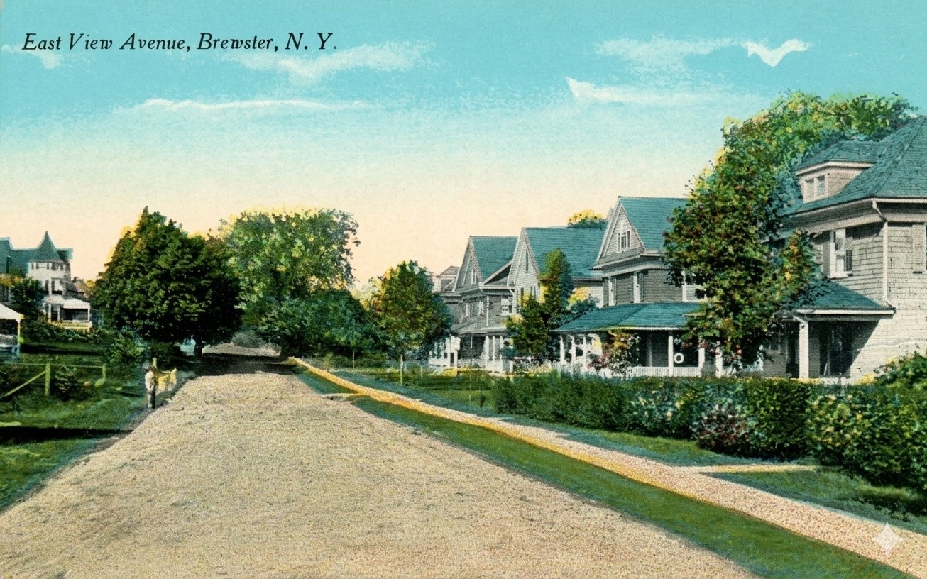
- “East View Avenue, Brewster, N.Y.” — early-twentieth-century color picture postcard, New York Heritage Digital Collections (Putnam County Historian’s Office), item pchc:471. The copy reproduced here is an AI-assisted digitally enhanced version; the original web scan and the higher-resolution master (Historian’s Office) are the authoritative artifacts and should replace it for publication.
- Modern photograph of the Queen Anne house on the “By Ways” corner (the lot deed-identified) — digitally enhanced; photographer credit to be confirmed. The building’s identity carries the Section V reservation.
- St. Lawrence O’Toole (hub) · The Ganong House Move · The Morehouse Factory · The Gilroy House
- Major Frank Wells and William M. Smalley — the land-consolidator and builder behind the “sister houses” on Eastview Avenue, the residential development context for “By Ways.”
- The 1922–1926 ownership chain is established from contemporary newspaper reports; occupancy and title are tracked separately (the Breartons and then the Reinhardts occupied as others held title). The identification of the modern parcel as “By Ways” is established by a continuous chain of deeds running from the present owners back to the documented 1926 sale; the one remaining reservation concerns the standing building (the 1959 Ganong move and a shared Griffin name), treated as a caution rather than a connection. See the project methodology.
Research by Rob G. · Eastview Avenue Series