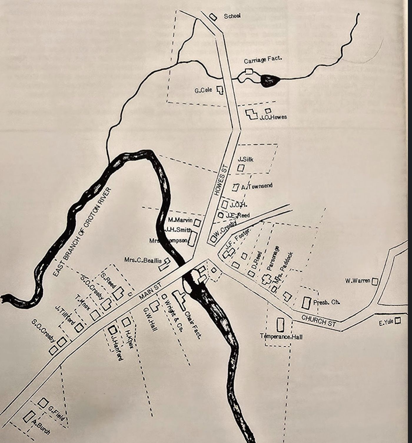
A Settlement Since 1745
Southeast Centre was not a new place when the City came for it. The earliest documentary record is a 1745 highway survey that names two mills in Southeast: a Morehouse mill at Milltown and a John Dickinson mill at Southeast Centre. James Dickinson is identified as the probable earliest inhabitant, his house standing near the junction of the roads to Milltown, Carmel, and Westchester County — "where the Croton River crossed the turnpike." A 1756 affidavit lists over 300 settlers as tenants of the Philipse family in the region; the surnames include Crosby, Crane, Paddock, Barnum, Foster, Cole, and Townsend — the same families who would still be farming at Southeast Centre when the reservoir notice arrived 131 years later. By the mid-nineteenth century, it was one of the oldest continuously inhabited settlements in Putnam County, a place that had "approached village rank" alongside Milltown.G
The Croton System and Its Expansion
New York City's first reliable water supply, the Old Croton Aqueduct, opened on July 4, 1842. For a generation it was adequate. But the city's population was exploding — driven by immigration and industrialization — and by the 1860s demand was threatening to outpace supply. The solution was expansion, northward into Putnam County, where the Croton River's tributaries offered the storage capacity the city needed.
The first Putnam County reservoirs came quickly. The Boyds Corners Reservoir entered service in 1873 and the Middle Branch Reservoir in 1878 — the latter visible today across Route 6 from the former Gay Nineties Inn property. Then, between 1891 and 1897, five more reservoirs entered service in rapid succession. The Town of Southeast ultimately found itself host to five of these reservoirs: part of the Croton Falls Reservoir, and all of the Middle Branch, Bog Brook, East Branch, and Diverting Reservoirs.A
The Village Knew Before the Notice Arrived
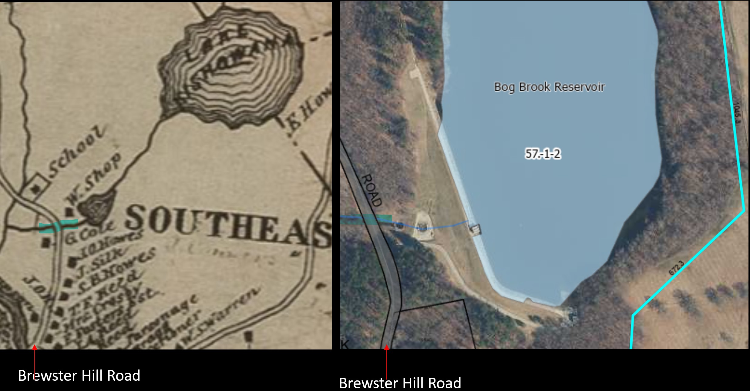
The 1887 New Aqueduct Notice was the formal beginning of the takings, but it was not the first the village heard of the project. Surveyors had been quartered at Hiram Paddock’s residence as early as May 10, 1878, and the village correspondent for the Brewster Standard reported speculation that “a site for the new dam at Southeast Centre is to be determined upon” — alongside competing rumors that the project might involve diverting the Housatonic River into the Croton, or that only the Ten-Mile River would be utilized. By March 24, 1882, the same paper could report with certainty: “The appearance of things during the past two weeks points very strongly to the conclusion that a reservoir is to be built at Southeast Centre.” The article documented that a portion of the New England Railroad track running past William A. Storm’s residence was to be relocated about 300 feet south of its existing bed, on higher ground, because the existing road bed would be flooded to a depth of about six feet under the contemplated reservoir.
That fall, an unsigned historical article in the Brewster Standard — written for inclusion in the corner-stone of the new Brewster Presbyterian Church — pinned the dam location precisely: “Another lake of similar dimensions is contemplated within the township. The survey locates the dam at Southeast Centre, near a sash and blind manufactory, owned by Isaac Armstrong. If the dam is built a fine farming section will be flooded and many pleasant homes will be broken up.” The Armstrong manufactory — a window-and-shutter shop whose interior blinds may have furnished some of the Stonehenge interior finish work nearing completion four years earlier — was the geographic landmark for the dam site five years before the formal taking. The village had clear knowledge of what was coming. The 1882 article’s acknowledgment that “many pleasant homes will be broken up” is the village’s own foreknowledge of its dispossession captured in print.
The Notice Arrives — July 1887
The formal beginning came on July 22, 1887, when the Brewster Standard published the New Aqueduct Notice. The City of New York announced its intention to apply to the Supreme Court for appointment of commissioners of appraisal under Chapter 490 of the Laws of 1883. The notice named the landowners whose properties would be affected and described the boundary of the proposed taking in precise legal language — a line that enclosed the heart of Southeast Centre.
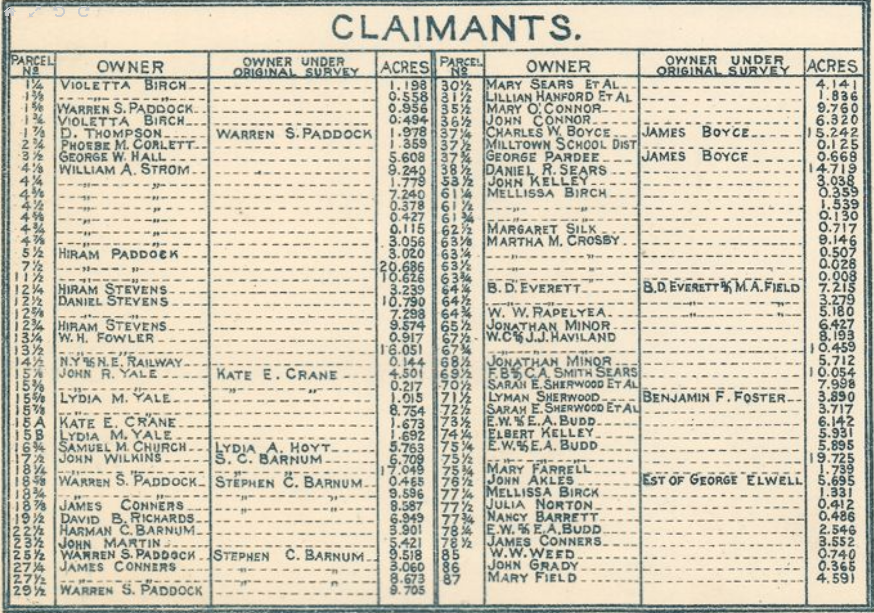
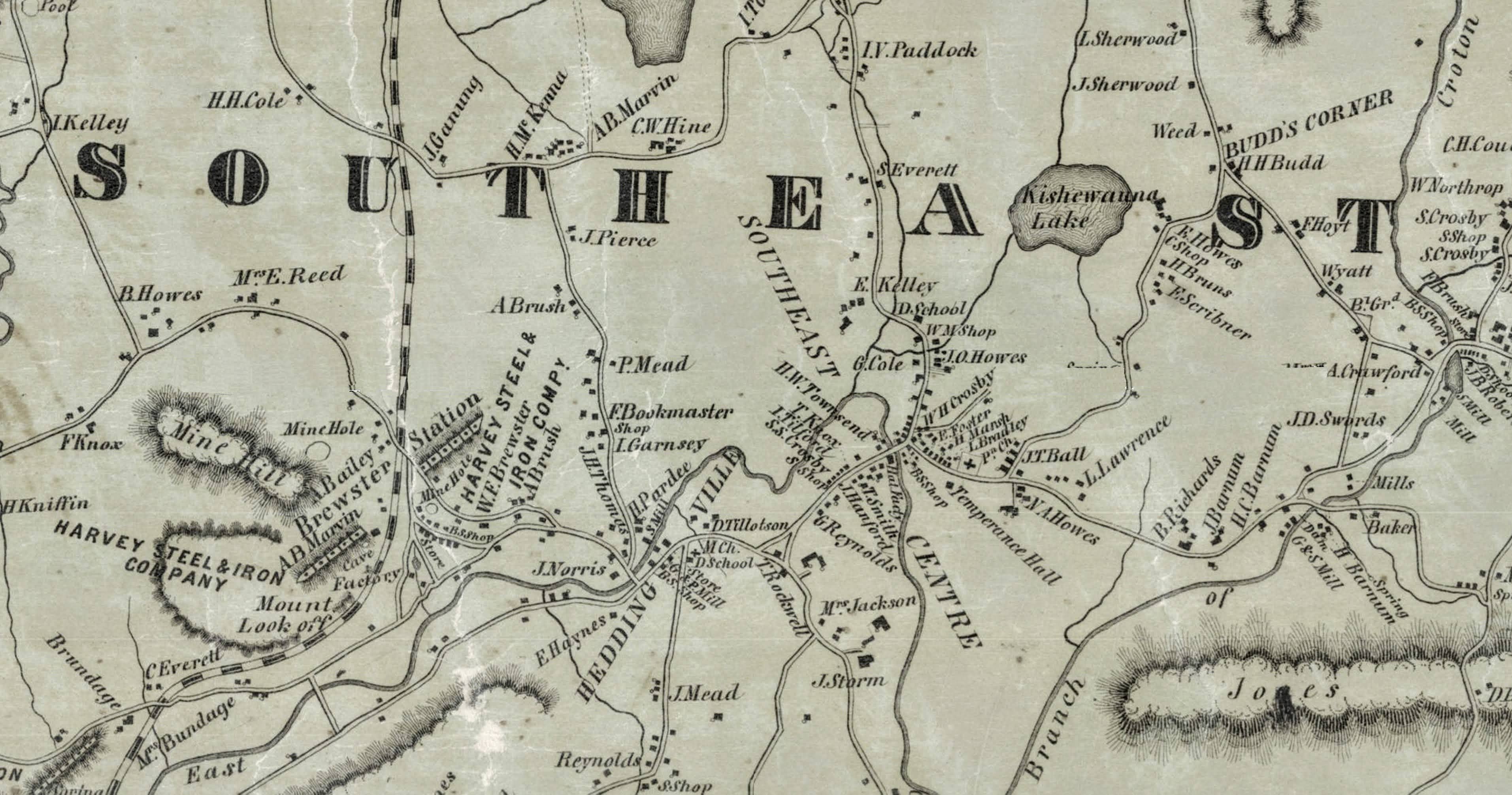
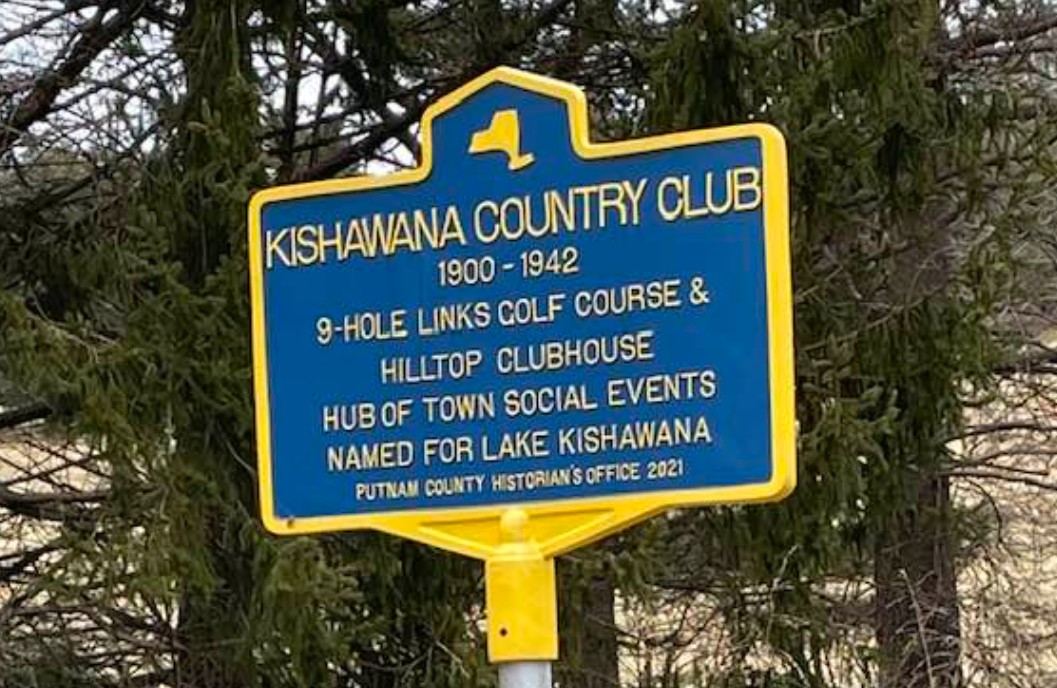
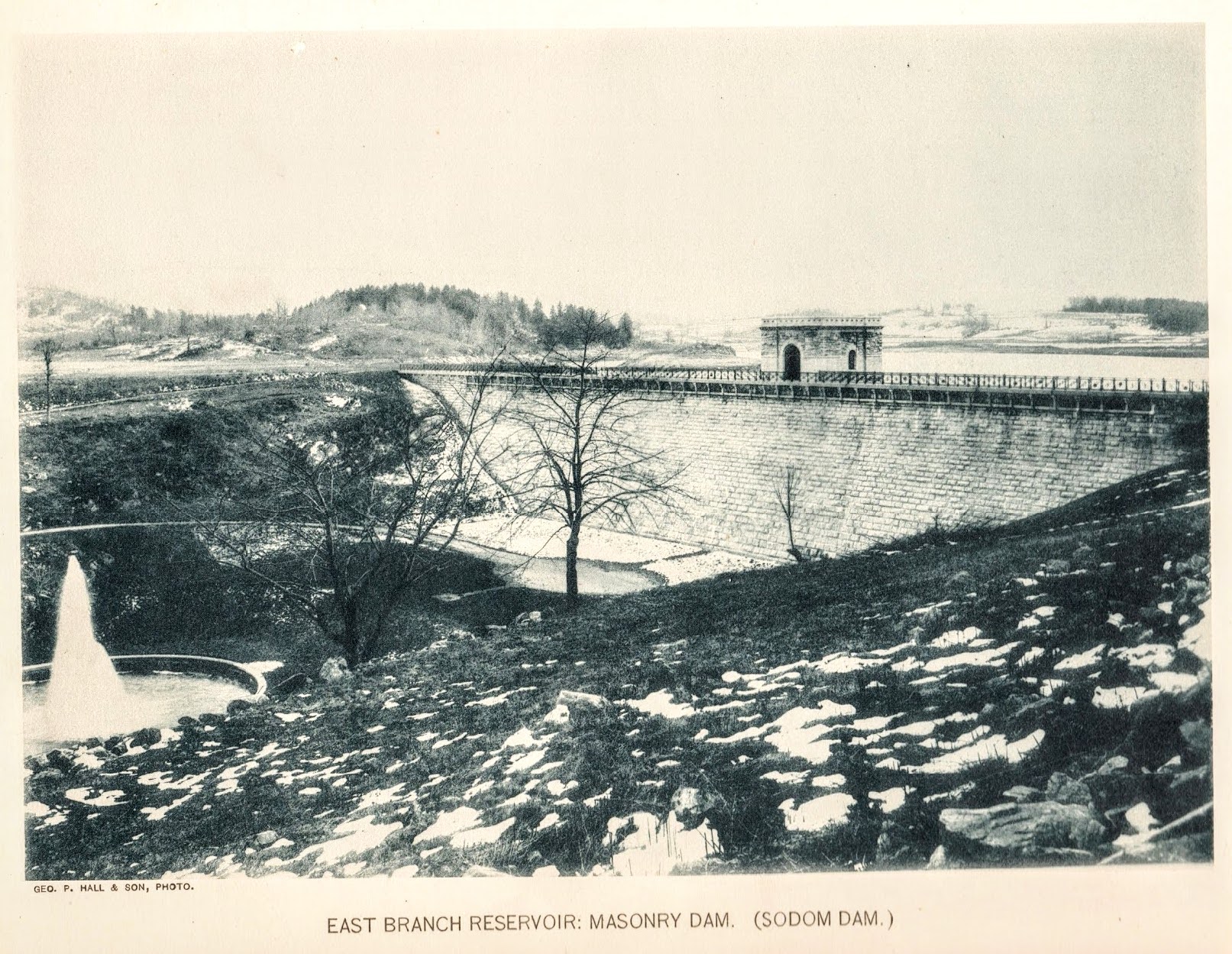
The notice identified the targets as the East Branch Reservoir (also called Sodom Reservoir) and Mud Pond Reservoir — what would become the Bog Brook Reservoir. The body of water the City called "Mud Pond" was labeled "Kishewanna Lake" on the 1867 Beers atlas; locals also knew it as Lake Kishawana. In January 1876, the Brewster Standard's Southeast Centre column had reported that "Mud Pond has been yielding a fine supply of perch and pickerel to the numerous fishermen of this neighborhood." By any name, it was the natural lake at the geographic center of the neighborhood. The notice named the starting monument "at lands of Violetta Birch," then traced a boundary through the lands of Melissa Birch, Lydia A. Yale, Albert Townsend, Stephen C. Barnum, Hiram Paddock, Jonathan Minor, George Cole, and Albert Townsend. (Vilettee Howes Birch — Jacob O. Howes's daughter — appears in contemporary deed indexes and newspaper accounts variously as Violetta, Violette, or Vilette; her gravestone at Milltown Rural Cemetery records her name as Vilettee, the spelling used in this research. She is not to be confused with her aunt and namesake Villette Howes, a daughter of Daniel and Ruhamah who died in 1827, eight years before this Vilettee was born in 1835 — see the J.O. Howes Farm narrative. Where deeds and notices are quoted, the source's own spelling is preserved.) Every name on that list corresponded to a family that had been in Southeast Centre for decades.B
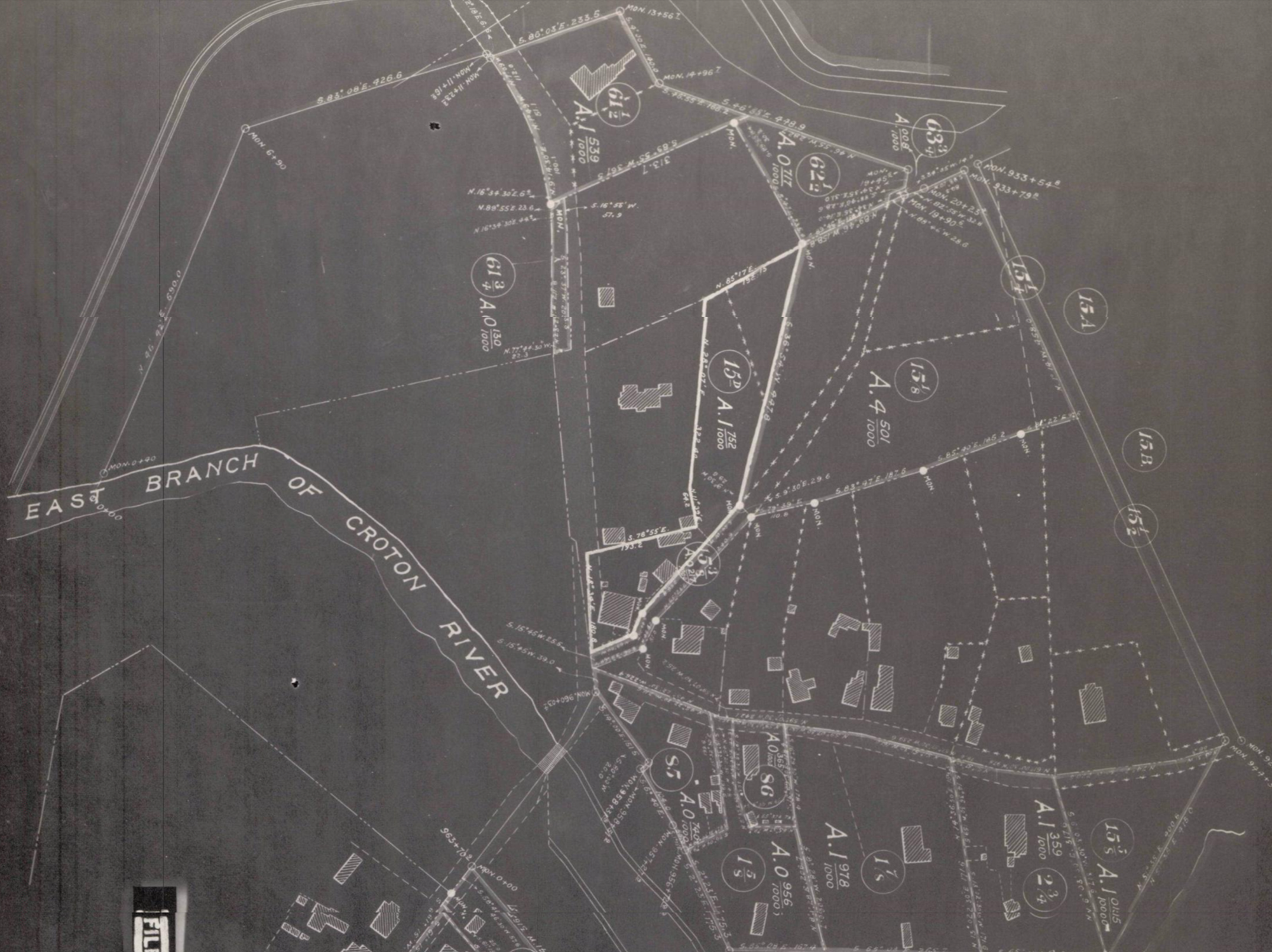
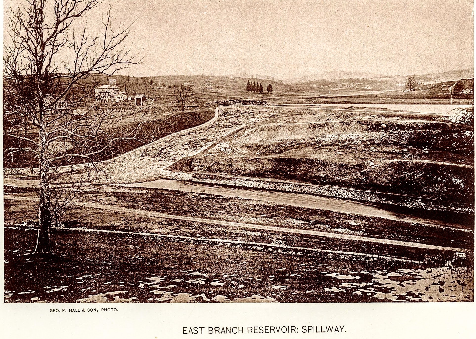
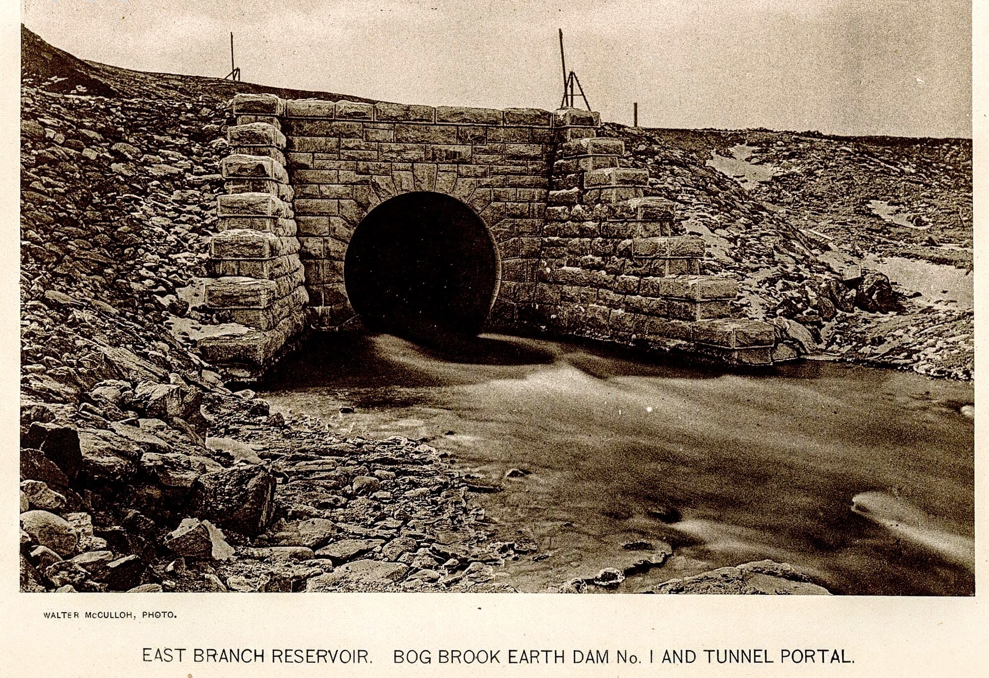
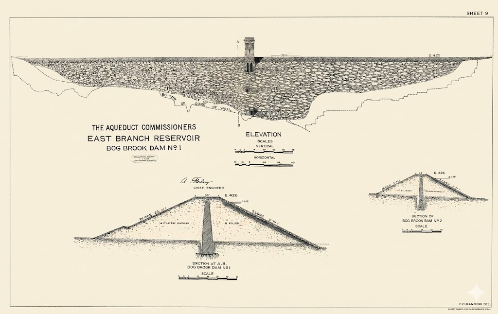
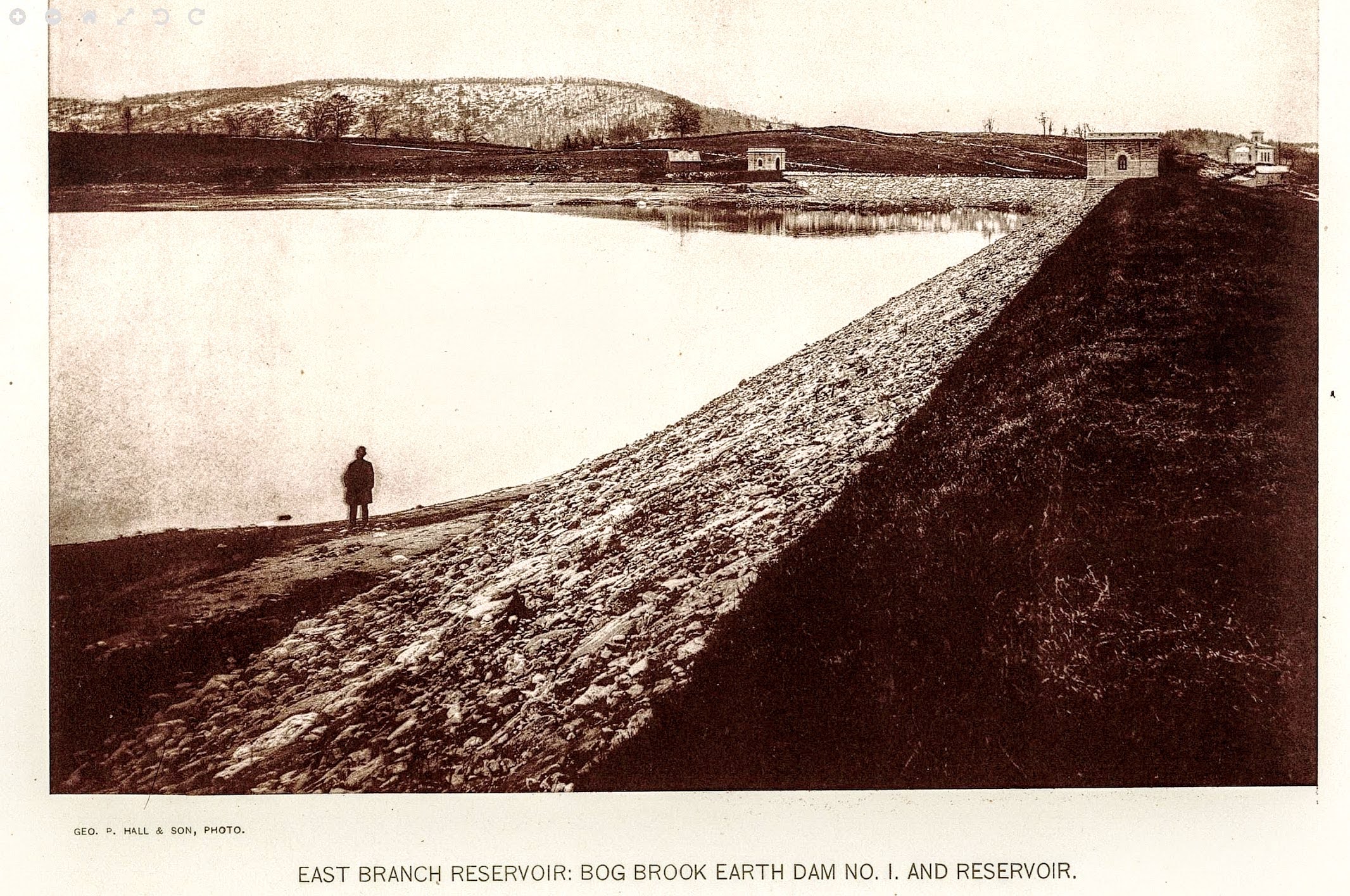
One week later, on July 29, the Standard published a detailed follow-up under the headline "Double Reservoir 'I'." Maps distributed by Hamilton Fish Jr. of the Aqueduct Commission showed the total area to be covered by water at nearly 1,500 acres — three times the land taken for the Middle Branch Reservoir thirteen years earlier. Ninety-three parcels were identified for flooding. Surveyors were already in the field, setting 2,700 monuments to mark the boundary. The reservoir was called "double" because two dams were required: the masonry dam at Sodom, and an earth embankment 1,500 feet in length to be thrown across the low lands along the Mud Pond outlet "near the residence of George Cole." Among the ninety-three parcels was one that was not a farm, not a house, not a road — it was the lake itself: "Kishawana Lake (Mud Pond), Parcel 79, 23.549 acres." They condemned the lake.H
At the Special Term of the Supreme Court at White Plains the same week, Corporation Counsel O'Brien moved for appointment of commissioners to appraise the 1,410 acres to be taken. The property owners were represented by Frederic S. Barnum — the same man who appears throughout this research as notary, estate administrator, and son-in-law of Francis E. Foster of Lot 3 — and by Abram J. Miller. They did not oppose the taking, but "requested the Court to use the utmost care in the selection of the Commissioners, in view of the value and extent of the property interests involved." Judge Dykman appointed Charles Denton, president of the First National Bank; Philip D. Penny, Supervisor of Patterson; and Robert Sewell, a New York City lawyer.H
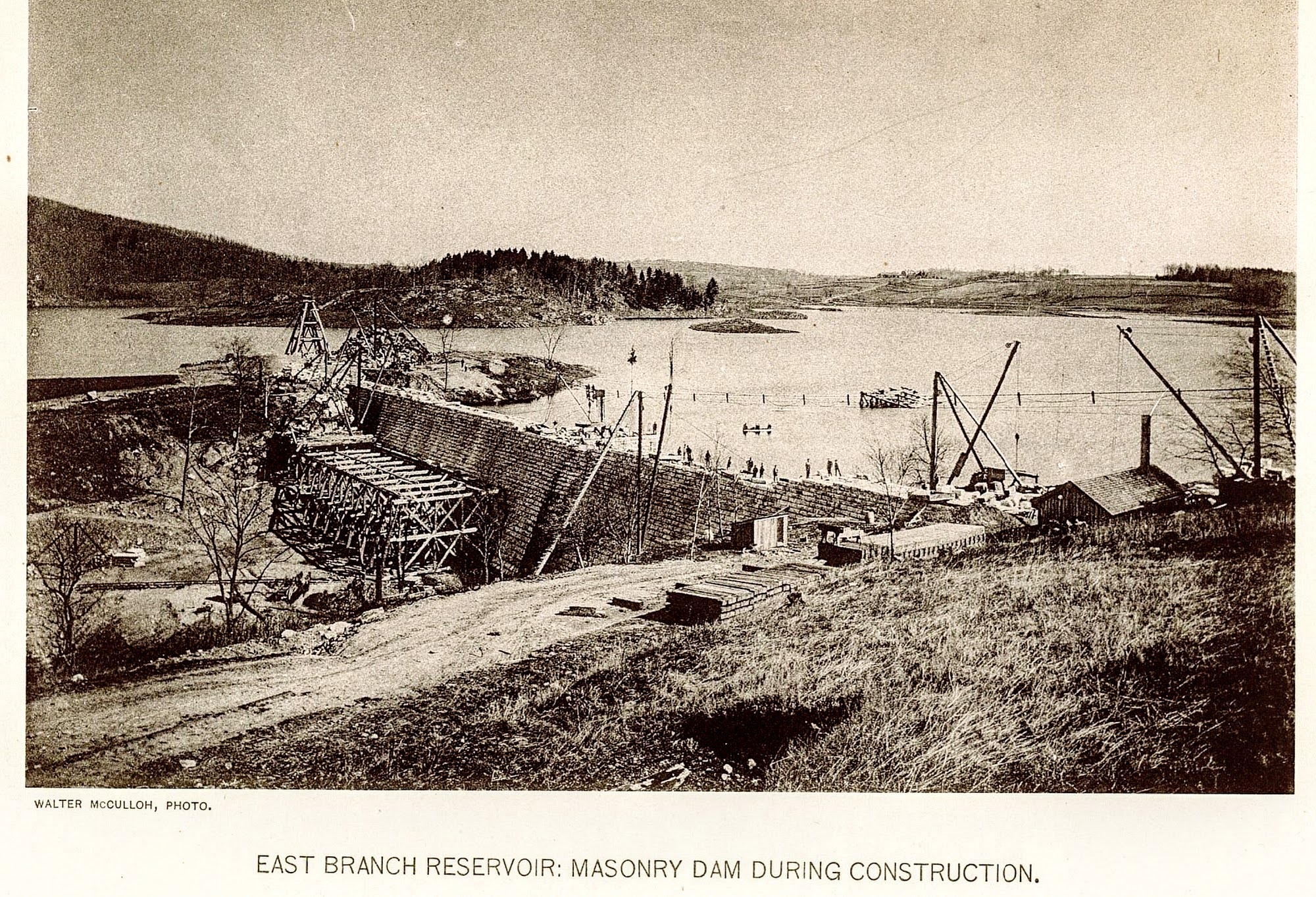
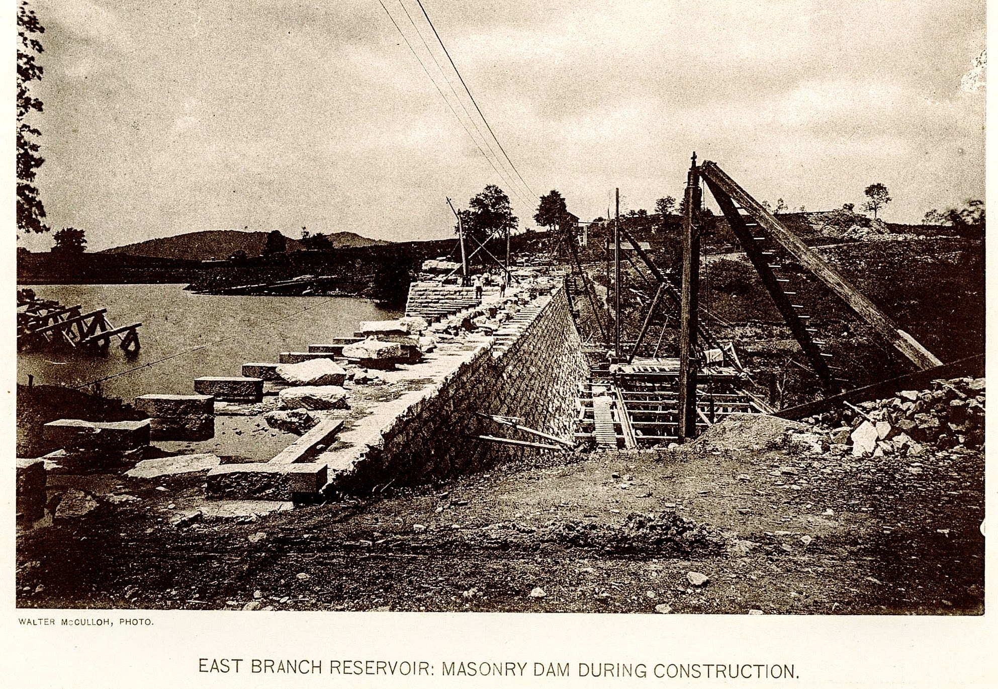
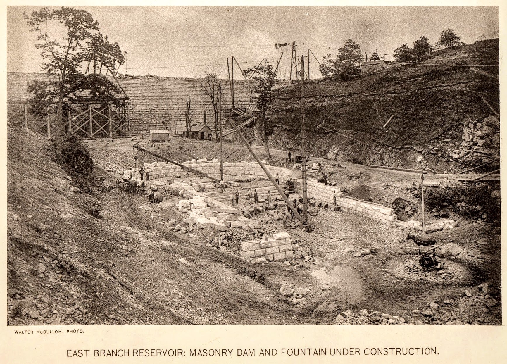
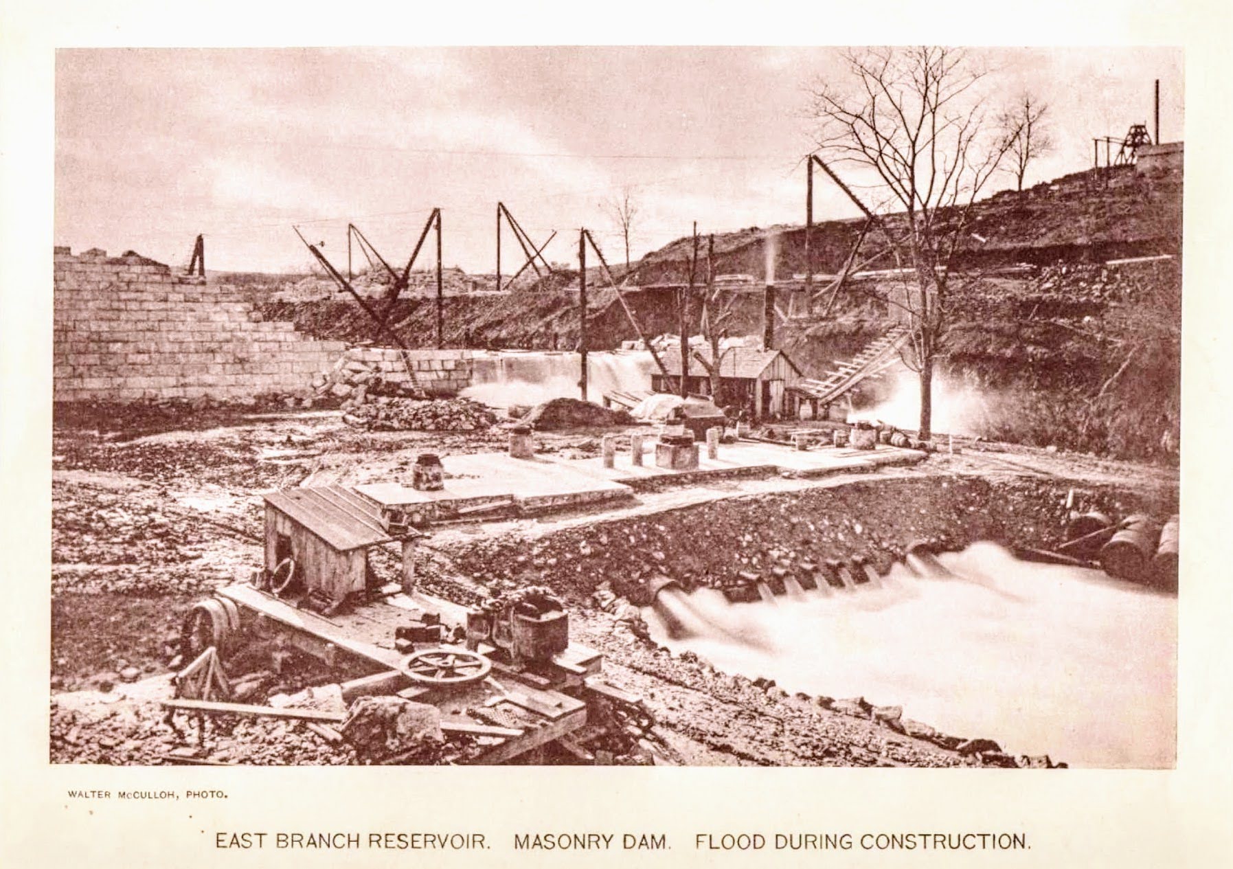
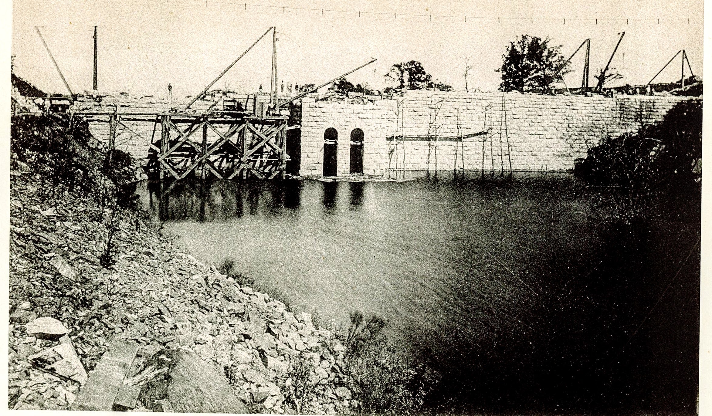
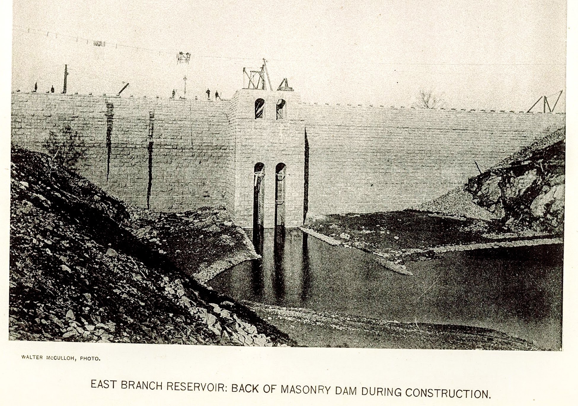
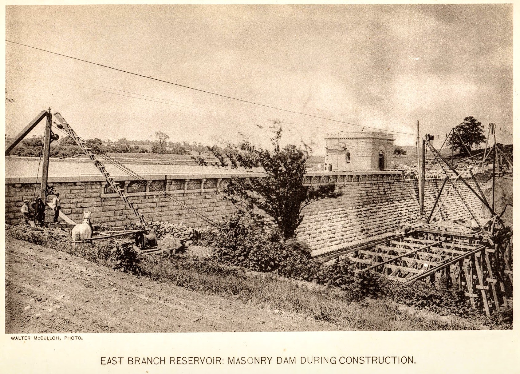
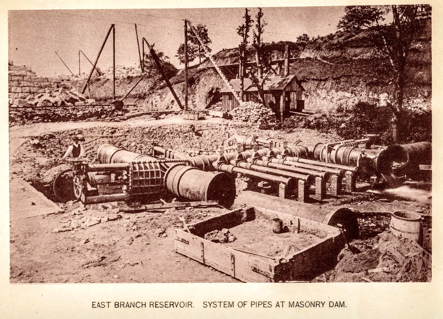
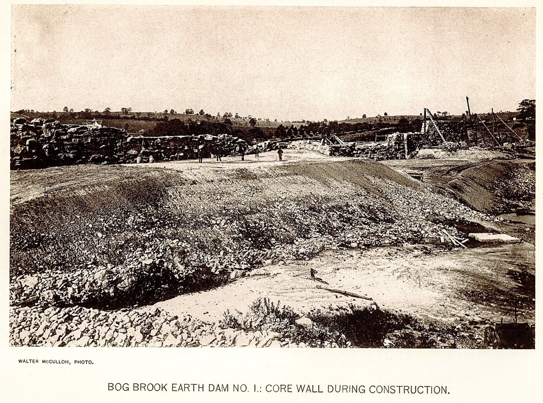
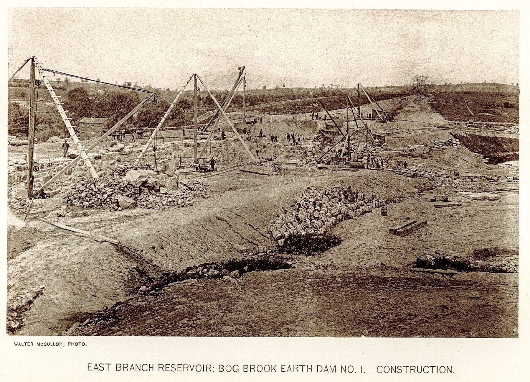
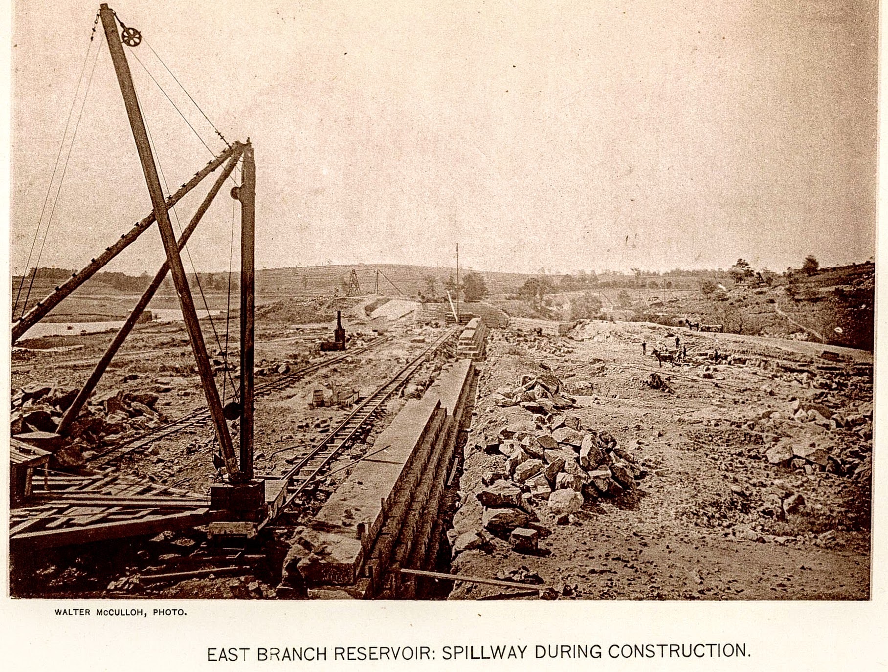
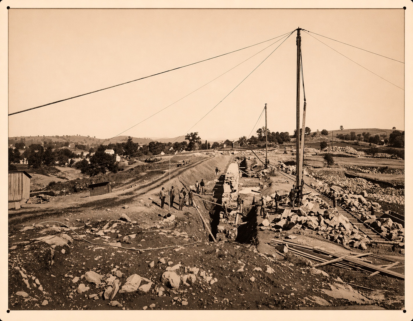
Construction — 1888 to 1893
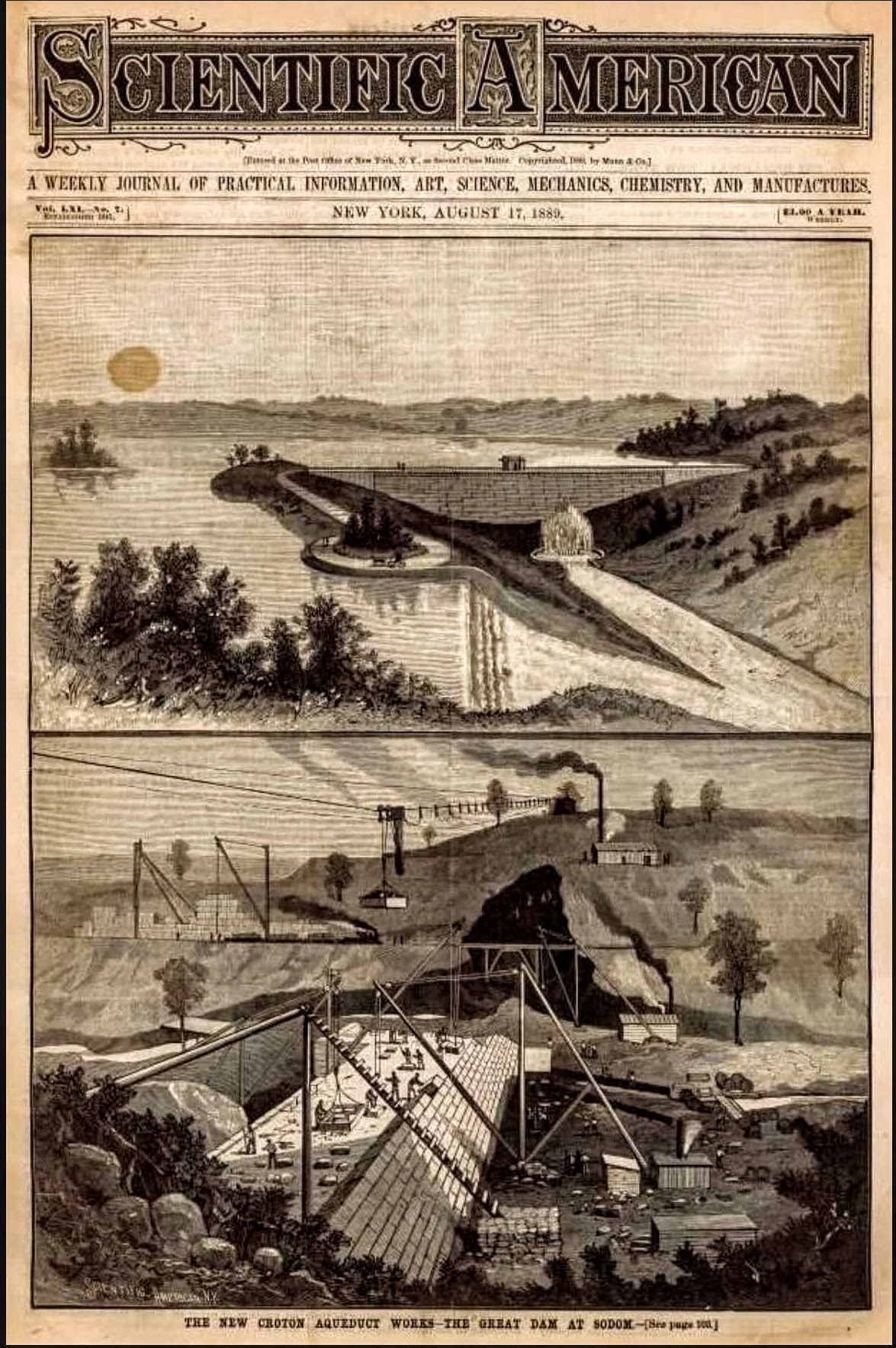
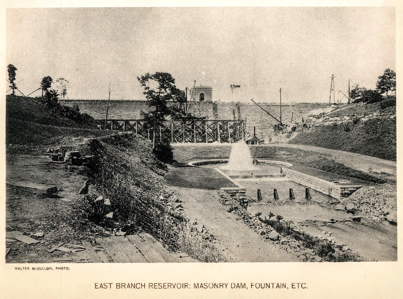
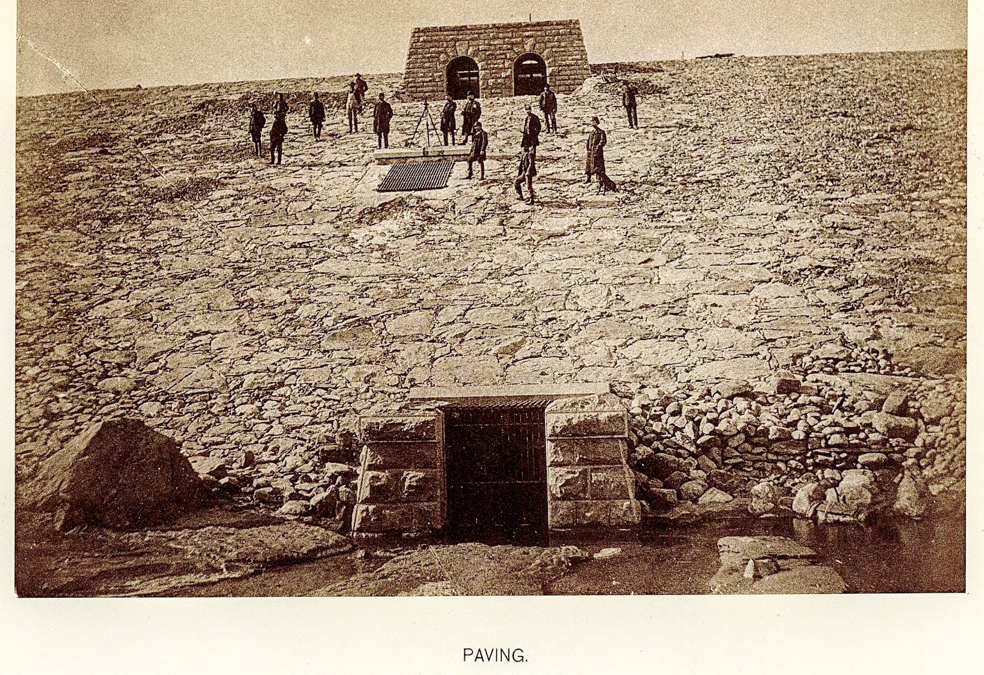
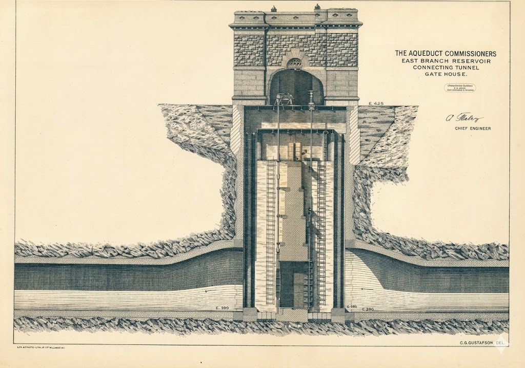
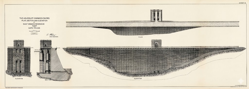
Construction of the East Branch Reservoir and Sodom Dam began in 1888 when the East Branch of the Croton River was diverted. The project was ambitious enough to attract national attention. The August 17, 1889 issue of Scientific American — published three months after the Johnstown Flood — featured the Sodom Dam on its cover and an engineering article by Harold Brown, C.E., Hydraulic Engineer. Brown's article was framed explicitly as reassurance to an anxious public, defending the safety of the earthen dams then under construction "in terms more forcible and 'terse' than technical." Supervised by hydraulic engineers and employing cutting-edge technology, crews built stone retaining walls, culverts, bridges, and extensive rip-rap to prevent erosion, while a steel cable system transported massive stones across the construction area. The completed impoundment would hold 5.2 billion gallons of water — Brown's 1889 article had projected 9 billion, an estimate revised downward as construction proceeded — and connect via a 1,773-foot tunnel to the neighboring Bog Brook Reservoir.C

The human cost was not abstract. In May 1889, while the East Branch dam was under construction, the catastrophic Johnstown Flood in Pennsylvania killed more than 2,000 people after the South Fork Dam collapsed. News spread quickly, and fear ran through Brewster and Southeast Centre — communities living just downstream from a dam then being built. Seth Benedict Howes and his wife Amy would move to higher ground on Turk Hill within a few years, drawn in part by this fear.
Tragedy struck locally that same construction season: in fall 1889, a steel cable carrying platforms loaded with stone and cement snapped, sending a heavy cart crashing down and killing Rocco Giuseppe Pellettiere, a thirty-four-year-old Italian immigrant laborer who left a wife and two young children in Italy. The following September 13, 1890, a violent storm struck the construction site. A bolt of lightning hit a workers' shelter near the Sodom Dam stone works, killing four men instantly — Nicolo Bellizza (17), Umberto Desantes (22), Bruno Butucci (44), and Antonio Gabrile (45). According to the Brewster Standard, two hearses made multiple trips to carry the men to a single grave at St. Lawrence O'Toole Catholic Cemetery in Brewster.C
Twenty-One Families — December 1889
The Brewster Standard reported in December 1889 that twenty-one families had already been displaced by the watershed proceedings, with 1,471 acres taken. The Carriage and Chair Factory that had anchored Southeast Centre's commercial life was demolished that same month. Most of the neighborhood's economic infrastructure — the wagon shop, the hat factory, the water-powered mills — was gone or condemned.
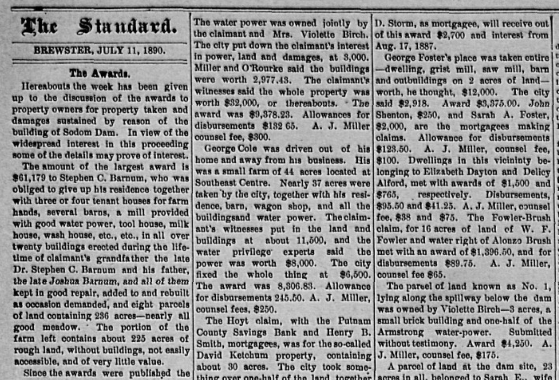
The Reckoning — Awards Published July 1890
The July 1890 Brewster Standard published the commissioners' awards in full under the headline "The Awards." The article documented what was lost, family by family. Stephen C. Barnum received $61,179 for a three-generation farm of 250 acres with twenty or more buildings, a mill, and water power — he had claimed $182,000. Lydia M. Yale received $17,077.50 for the 130-acre farm her husband had paid $13,000 for in 1858 and improved over three decades; all 108 acres and every building were taken. George Cole of Southeast Centre lost 37 of his 44 acres along with his residence, barn, wagon shop, and water power — "driven out of his home and away from his business." Vilettee Birch, holding three acres at the spillway with a small brick building and half the Armstrong water power, received $4,260. The Armstrong property at Southeast Centre — the mill and water power that had anchored commercial life at the intersection for generations — was, the Standard reported, "taken away entirely."
Melissa Howes Birch — Jacob O. Howes's daughter, who had grown up on the 140-acre family farm — had refused an offer of $25,000 the year before the taking. The commissioners awarded her $15,700. Her residence and farm structures were left standing on the remaining few acres; it was during this liminal period, after the taking but before the reservoir rose, that the farmhouse was photographed. The surviving image — captioned "before 1895" — is the only known photograph of the Howes family farm at Southeast Centre.D
The Supplementary Rounds — 1896 to 1900
The proceedings continued through the 1890s. A January 1896 article documented 57 additional parcels — approximately 420 additional acres — taken in a supplementary round for the Double Reservoir I proceeding. The Double Reservoir I map was filed at the Putnam County Clerk's Office on May 14, 1896. By this point the taking was a matter of irrevocable public record.
Melissa Birch released three additional parcels to the City in September 1900, receiving a combined award exceeding $10,000 for what remained of her holdings. Vilettee Birch, as sole surviving executrix of Jacob O. Howes's estate, released the estate's upland parcel to the City on October 4, 1900, for $1,310. Melissa's total watershed awards across all proceedings exceeded $40,000 — one of the largest individual compensation figures in Southeast Centre — yet every dollar represented land that had anchored the Howes family in this valley for three generations.D
What Was Lost
Diane Galusha's history of the New York City water system records that most of Southeast Center was taken for the East Branch Reservoir, and that more than 200 buildings were auctioned and torn down or moved to make way for the reservoirs in the broader area. The Borden Condensary in Brewster — which had processed milk from as many as 200 farms — saw its fortunes dwindle as those farms were displaced and finally closed in 1915, a delayed casualty of the same watershed takings that had emptied Southeast Centre a generation earlier.E
The Presbyterian church — organized June 14, 1853, built and dedicated in 1854 — was sold July 1, 1891 to John R. Yale and James D. Baxter for $104, but the deed conveyed only the ground; the meeting house itself was demolished during the reservoir construction era. The original Sodom district school site at the top of Howes Street was taken by condemnation. The lot then sat vacant through the 1890s. On June 28, 1901, the Brewster Standard reported that the taxpayers of Sodom school district had voted to purchase “the old Presbyterian church property of John R. Yale” for $300 as the site of the new district schoolhouse, and a new building was erected on the cleared lot. What carried over from the pre-watershed schoolhouse to the 1901 building was the district — the same Common School District No. 6 — not the structure. The old school board meeting that considered Lot 1 (immediately adjacent to Stonehenge) as a replacement site in June 1901 was pre-empted when Ruhamah Heartfield purchased the property six days before the community meeting — the school was never built there. What remains of Southeast Centre is the cluster of village lots on Brewster Hill Road and Sodom Road still in private hands, where the structures still stand — documented in this project from their earliest deed records to the present owners.
The Watershed at War
The watershed did not stop being a story when the last condemnation deed was recorded in 1900. By February 9, 1917 — six days after the United States severed diplomatic relations with Germany and two months before the formal declaration of war — the same Brewster Standard that had published the 1887 New Aqueduct Notice and the 1890 Awards column reported that more than seven hundred guardsmen were patrolling the Catskill Aqueduct and the Putnam County reservoirs, including Sodom Reservoir specifically by name. National Guard companies from Newburgh, Binghamton, Oneonta, Middletown, and Mohawk were lodged in school houses, the Peekskill Court House, and "houses and sheds" along the aqueduct line. Special attention was being paid to exposed sections of the tunnel and to the Croton River viaduct at Harmon. The article closed with the arrest of one Oscar Marx of Lake Mahopac, taken by Secret Service agents and reportedly carrying maps of the city's reservoirs and aqueducts on his person, and with a pointed editorial line about the metropolitan press: "The New York newspapers are unusually quiet on the subject. Perhaps there is a reason." The land that had been taken from the families of Southeast Centre had become, in less than a generation, a piece of national security infrastructure — patrolled, mapped, contested, and watched.
The Historic Marker
The total cost of the East Branch and Bog Brook Reservoir project was $1,981,658. In 1896, under the same statute, additional proceedings acquired a further strip of land around the reservoirs — a supplemental taking distinct from the original acquisition, extending the City's control over the watershed buffer.G
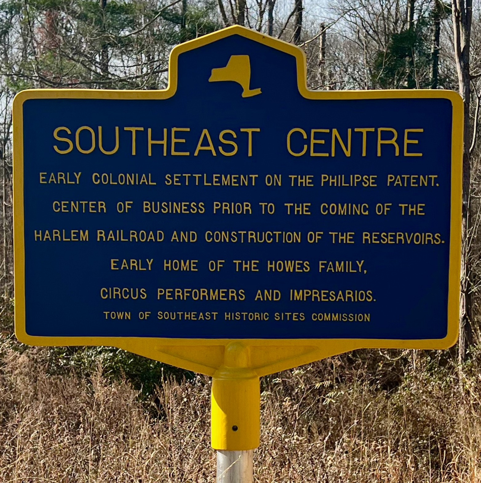
Two New York State historic markers, both sponsored by the Town of Southeast Historic Sites Commission, stand within a short drive of one another. One sits at the intersection of Milltown Road and Old Milltown Road, near the reservoir loop road, and reads: “East Branch Reservoir — Put in service in 1891 & connected by tunnel to Bog Brook Reservoir to impound nearly 10 million gallons of clean water for the Croton Reservoir to meet the growing demands of NYC.” The other stands at Southeast Centre itself and reads: “Early colonial settlement on the Philipse Patent. Center of business prior to the coming of the Harlem Railroad and construction of the reservoirs. Early home of the Howes Family, circus performers and impresarios.”F
Primary Source Documentation
The individual awards from the July 1890 proceeding — 53 named claimants plus four pending awards, with acreages and award amounts — are documented in full from the primary source Brewster Standard transcription.